In the Neighbourhood of Mount Kilimanjaro
I was going to finish up part two of the Sunshine Coast trip today, but I was clearing up some old unread emails and came across NASA Earth Observatory's latest email newsletter. So I was clicking on the links in the email and ...well, you're getting another post on volcanoes instead!
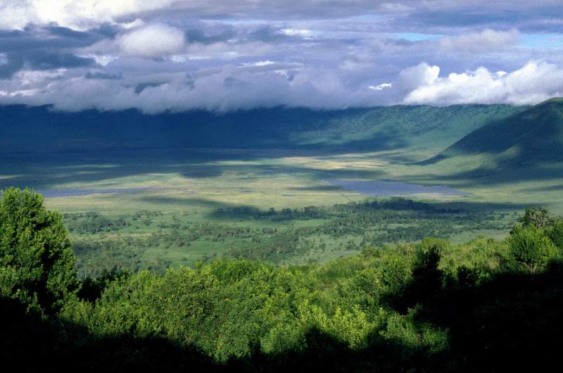
 Here is the new image from NASA’s Earth Observatory showing the Crater Highlands to the west of Kilimanjaro in Tanzania. There are several volcanoes in the image and the largest crater, Ngorongoro Crater (more correctly called Ngorongoro Caldera), is the largest unbroken and unflooded caldera in the world. The Ngorongoro volcano was one of the world’s tallest mountains along with Mount Kilimanjaro before it exploded and collapsed 2 million years ago. The crater is about 19 kilometres (12 miles) across and the rim is 600 metres (2,000 feet) above the crater floor.
Today, Ngorongoro Crater is home for tens of thousands of big East African wild animals, including lions, elephants, wildebeests, zebras, rhinos, Thomson's gazelles, and water buffaloes.
 This web page (where I snagged this photo and where you can see a much larger version of the photo) has magnificent photographs of the Crater and its wildlife.
Ngorongoro Crater is on the eastern edge of the Serengeti. Both the Crater and Tanzania’s Serengeti National Park are sites popular with safari-bound tourists. Stephen and Theresa Woo tell the story of their Tanzania safari in their photo journal. Lots of pictures!
Another interesting spot in the same area is the Olduvai Gorge, where in 1959 Louis and Mary Leakey discovered the 1.8 million year old fossilized skull of zinjanthropus, a human ancestor. The Gorge is rich with fossils, ancient tools, and footprints left millions of years ago.
To explore Tanzania further, here are some clickable maps.
posted by Roewan @ 3:33 PM
0 comments
![]()

0 Comments:
Post a Comment
<< Home